MONTEREY, CA to PORT ANGELES, WA.
Chuck arranged with his friend Gary, from Seattle, to help him bring the boat from Monterey to Port Angeles, Wa. If you all recall Gary and Chuck brought the boat south to Monterey last October. The trip NORTH along the west coast is problematic. Most boaters describe it as "going uphill". The reason is that the prevailing ocean swell is north to south, the wind is north to south, and the ocean current is also north to south. It can be a very rough trip. The key to making it as pleasant as possible is to look for a weather "window" of calm wind and seas. We started watching the weather reports from the NOAA internet pages in February and March, and it was really rough. Usually the earliest you can head north is early May, ideally late May or June. On Thursday, April 19th, it became apparent that there was a good window starting on the 21st, Saturday. Sometimes these windows are only 1-3 days but if this forecast was accurate we had almost a week of good weather. A quick call to Gary, he flew into Monterey on Saturday morning. I picked him up from the airport and that evening at 5PM we departed. It is almost 800 miles to Port Angelesand our estimate was a 5 day, NON STOP trip, only going into port for fuel. This trip would be longer than the trip south since we were working "uphill" and our speed wouldn't be as good as we had going south. WELL, what a surprise but our weather reversed the normal trend. Wind, waves and swell all from the south. The wind was always less than 20mph and the seas were relatively calm. We started making really good speed. Saturday night we passed by the entrance to San Francisco. This can be exciting as the large ocean going ships are coming and going, but that night we only had one large tanker to contend with. Our only issue, which we knew in advance, was sleep. We would each sleep 2-4 hours, one person driving, one sleeping. Once into a routine this was not that difficult. On Monday morning at day break we pulled into Crescent City, Ca. where we took diesel fuel and then went right back out. Most of the time we were hugging the coast, no more than 5-10 miles out. From the Oregon border to the top corner of Washington State the coastline curves east and because we made a straight line, we were 25-35 miles offshore. We also hired a professional yacht weather router who was advising us about conditions as we progressed. Up at the Northwest corner of Washington state is Cape Flattery. After rounding this cape we turned east and motored on the Strait of Juan de Fuca and into Port Angeles. We rounded this cape at daybreak. Around midnight, we had our only bad weather heading to the cape. Winds were in excess of 35mph, but all from the south. The boat rolled a few times quite hard, so we were grateful for our hydraulic stabilizers. We had anticipated 120+hours to do this trip, but pulled into port after 92 hours, just shy of 4 full days. We went 800 miles, burned 755 gallons of diesel, 1.05mpg, at a cost of $3252. All in all a very good trip. Chuck flew home to San Diego and of course Gary was almost home since we were not far from Seattle.
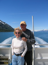
Chuck and Margaret
Off West Coast
Gary Driving off West Coast
At the dock in Port Angeles
Jul 6, 2012
Subscribe to:
Post Comments (Atom)


No comments:
Post a Comment